Twin Peaks
Steep or many steps
- 1Christmas Tree PointThe main lookout, some 70 feet below the North Peak, facing downtown and the Bay.
- 2The North and South peaksEureka and Noe, two grassy summits about 660 feet apart, reached by short, steep trails.
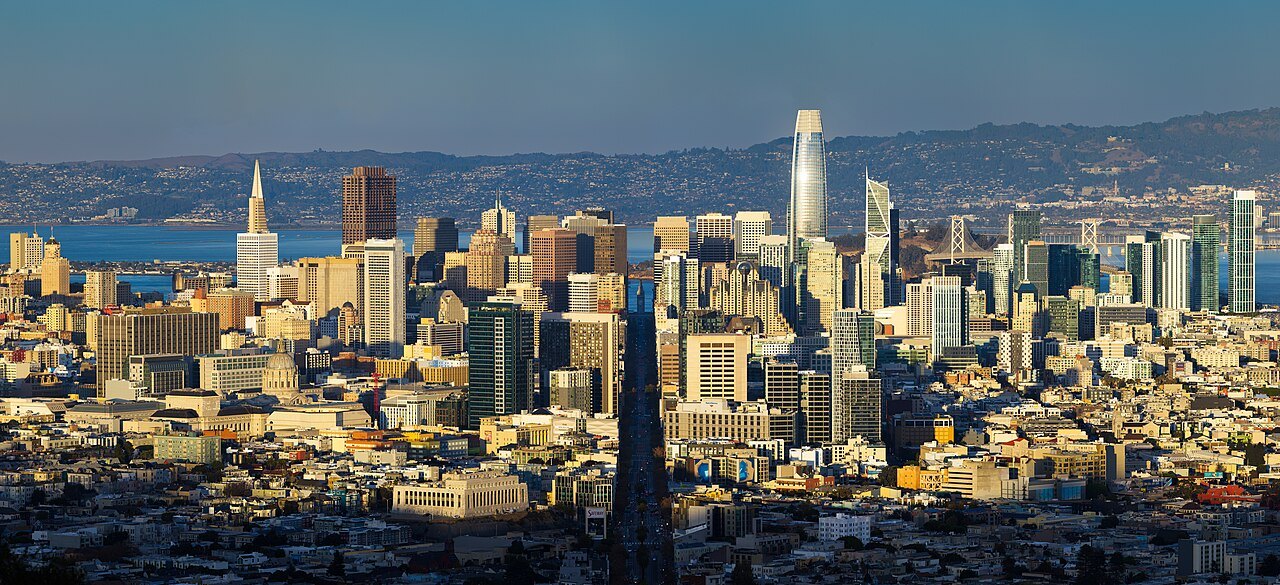
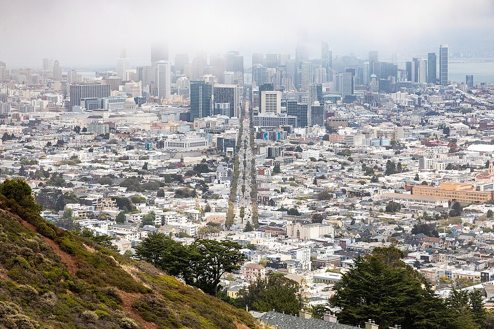
- 3The view down Market StreetThe city's great diagonal avenue running straight from the foot of the hill to the Ferry Building.
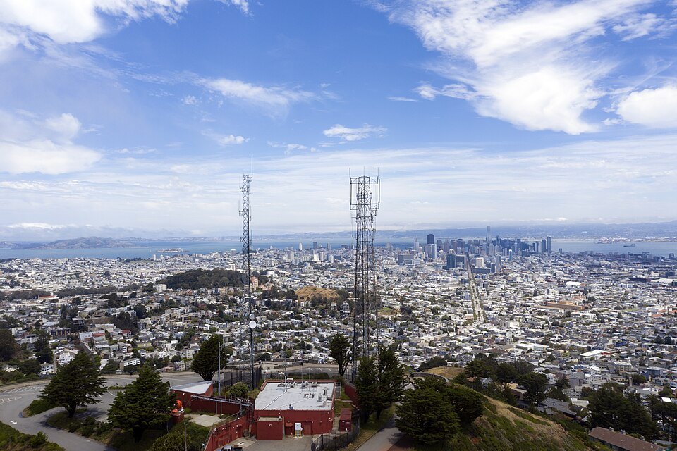
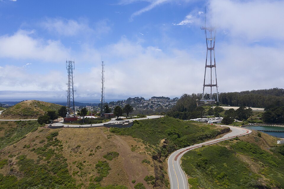
- 4Sutro TowerThe red-and-white three-legged broadcast tower of 1973, on the next hill to the west.
- 5The Twin Peaks Natural AreaThirty-one acres of preserved grassland and scrub, a refuge for the endangered Mission blue butterfly.
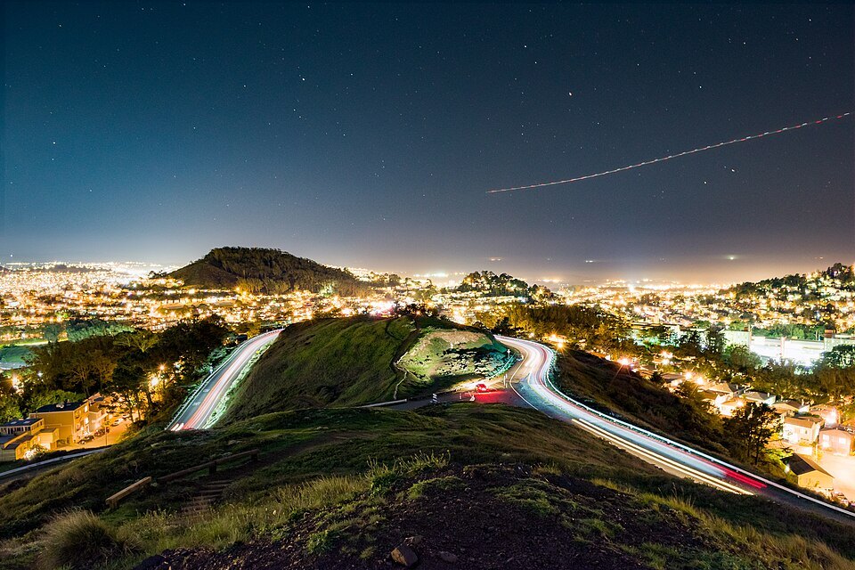
- 6The summit roadA loop around the peaks whose eastern side has been given over to walkers and cyclists.
Reading the place
Why it matters
Twin Peaks are two rounded, grassy hills close to the geographic center of San Francisco, each just over 900 feet high. Only Mount Davidson, at 928 feet, rises higher within the city. Because they stand in the middle, with nothing taller around them, they give the one view that shows the whole of San Francisco at once: downtown's towers, the Bay Bridge and the East Bay hills, the Golden Gate to the north, the neighborhoods rolling west to the Pacific, and, straight below, Market Street cutting across the city like a ruler.
They are also where you can watch the city's weather happen. The peaks form a divide for the summer fog pushed in from the ocean: their western slopes are often wrapped in fog and wind while the eastern slopes, and the Mission and Castro below them, stay sunny and warm.
Two names
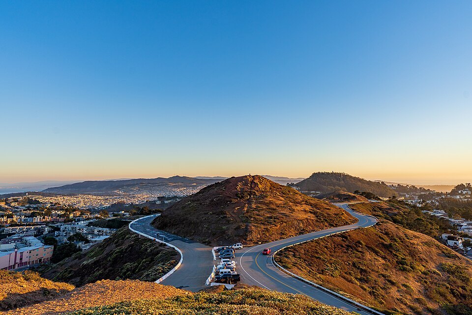
The Ohlone may have used the hills as a lookout or hunting ground. The Spanish settlers who ranched here called them Los Pechos de la Chola, the breasts of the Indian maiden; under American rule they became Twin Peaks. The two summits are known individually as Eureka, the northern one, and Noe, the southern. They are about 660 feet apart, with a saddle between them where the road runs.
The hills have never been built on. The summits belong to the 31-acre Twin Peaks Natural Area, managed by the city's parks department, and the thin, sandy soil and coastal scrub shelter one of the last habitats of the Mission blue butterfly, an endangered species, along with many birds and insects.
What you see
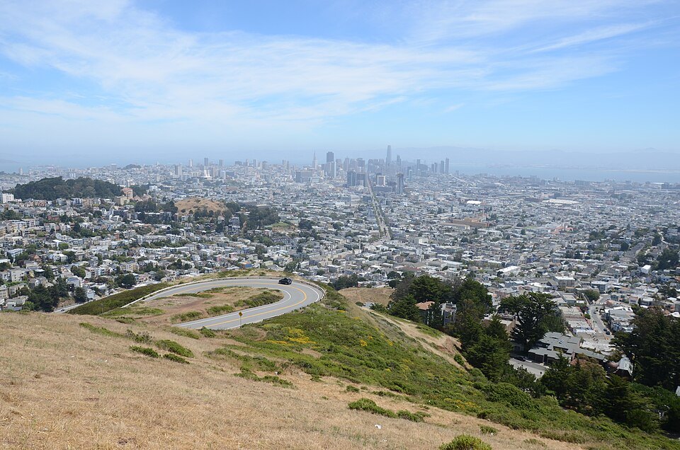
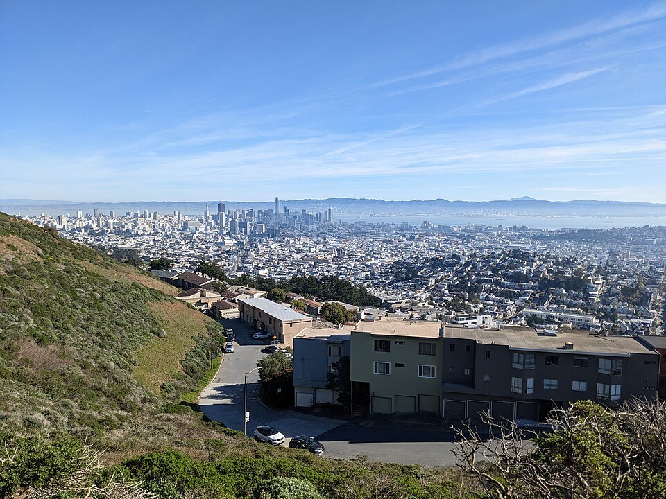
Most visitors stop at Christmas Tree Point, a lookout about 70 feet below the North Peak, where a low wall faces northeast over the city. From here the plan of San Francisco makes sense. Market Street runs straight from the foot of the hill to the Ferry Building on the waterfront, with the Financial District and the Salesforce Tower at its end, and the street grid spreads out on either side, climbing over Nob Hill and Russian Hill to the north. On a clear day the view reaches southeast down the Santa Clara Valley to mountains nearly ninety miles away, and north to hills some seventy-five miles off.
Turn west and the view changes completely: the Sunset and Richmond districts in long, pale rows toward the ocean, and, on the next hill, the red-and-white Sutro Tower. Completed in 1973, the three-legged tower gathered the region's television transmitters in one place, because the city's hills had blocked their signals; it was San Francisco's tallest structure until the Salesforce Tower passed it in 2018.
Below your feet, the Twin Peaks Tunnel, opened in 1918, carries Muni streetcars more than two miles under the hill from the Castro to West Portal; when it opened it was the longest street railway tunnel in the world, and it opened the city's southwest to development. North of the summit, a reservoir belongs to the Fire Department's separate high-pressure water system, built after the earthquake and fire of 1906.
The fog line
On a typical summer afternoon you can see the fog arrive. The marine layer pushes in from the ocean over the western neighborhoods, piles up against the western flanks of Twin Peaks, Mount Sutro and Mount Davidson, the city's highest hill, which is crowned by a concrete cross 103 feet tall built in 1934, and sometimes spills over the top in a slow white wave toward downtown. Together these hills act as a barrier that keeps the eastern neighborhoods sunnier and warmer, which is much of the reason San Francisco has so many microclimates; the when to come page explains the pattern. On very rare occasions the peaks have had snow: several inches fell here on February 5, 1976.
How to visit
Twin Peaks is a steep climb on foot from any neighborhood below it, whether up from the Castro or from Cole Valley; see the hills for the gradients and for the easier ways up. The summit road reaches Christmas Tree Point, and the city's changes since 2016 have given the eastern side of the loop to people on foot and bike. Many visitors come by taxi, ride-hail, tour bus or car. Muni buses run on the roads below the summit; see getting around.
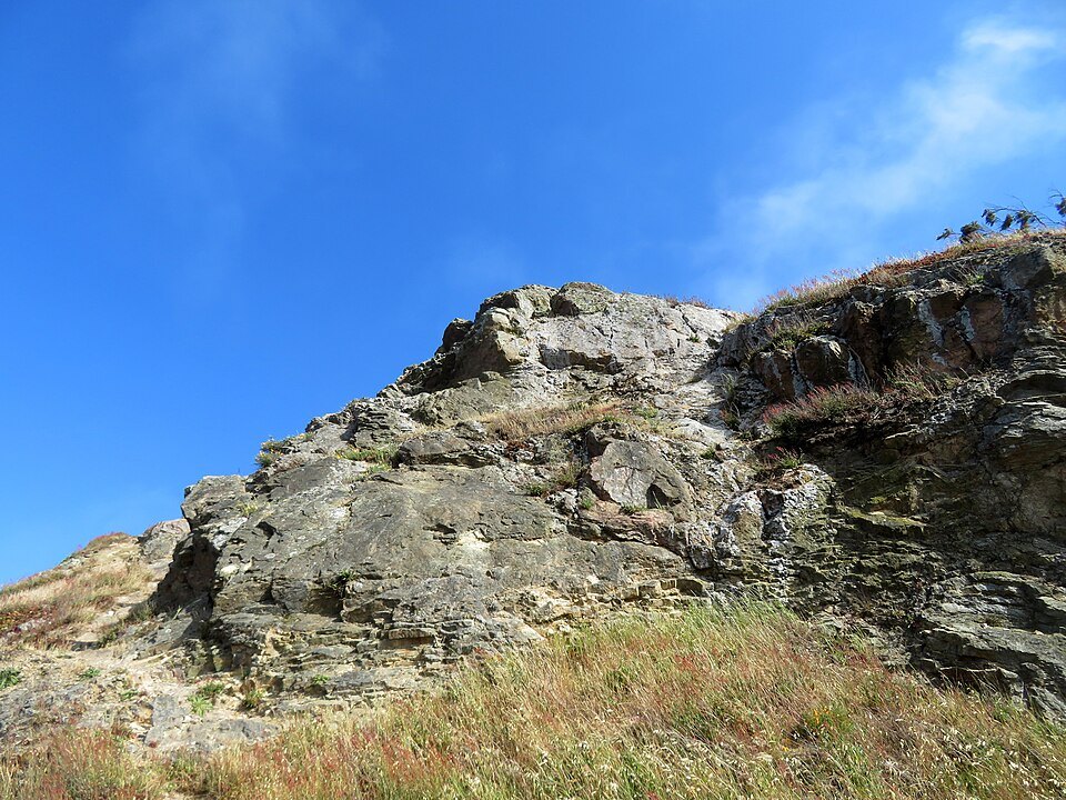
The walk up the short trails to the two summits themselves is steep, unpaved and exposed. The west-facing slopes take the full force of the ocean wind and fog, so bring a warm layer whatever the weather downtown. Clear mornings and afternoons before the fog comes in give the best views. Allow half an hour to an hour, longer if you walk to both summits or wait for the fog to come over the hill in the afternoon. The Castro and Haight-Ashbury are below on either side.
Myths and facts
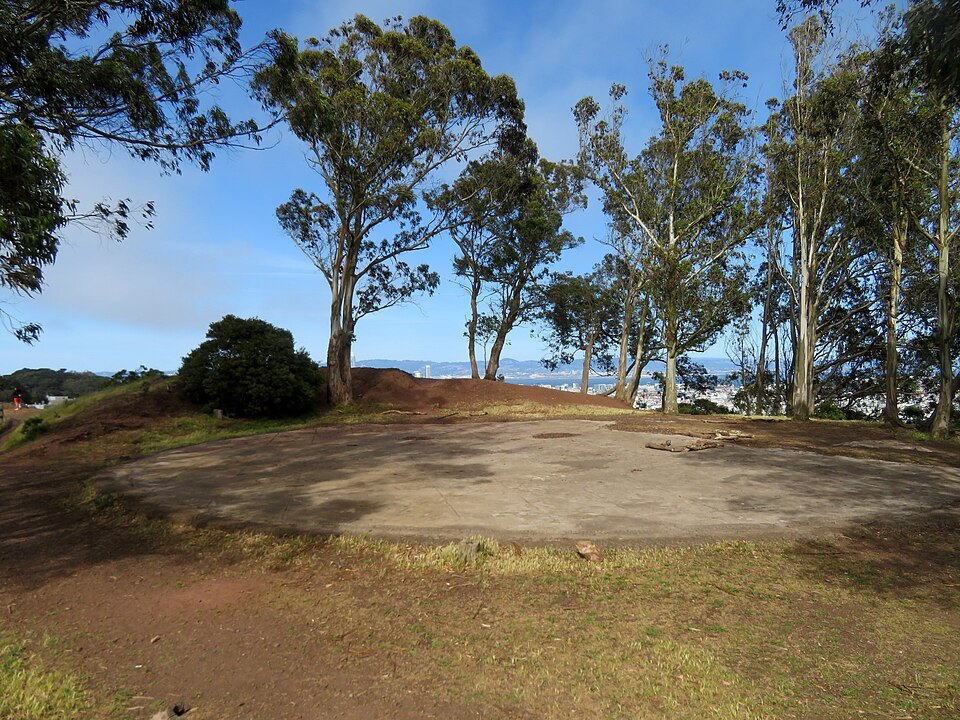
Twin Peaks is not the city's highest point; Mount Davidson, to the south, is a few feet taller. The view from Christmas Tree Point is not from the top either: the summits are a short, steep climb higher. And the tower on the next hill, which many visitors take for part of Twin Peaks, stands on its own hill between Twin Peaks and Mount Sutro, and takes its name from Mount Sutro, the 909-foot hill originally called Mount Parnassus, where the grandson of Mayor Adolph Sutro built a mansion later sold to a television company.
Nearby
- NearbyHaight-AshburyA district of tall, ornate wooden Victorian and Edwardian houses at the east end of Golden Gate Park, named for a street corner and remembered as one of the centers of the 1960s counterculture.Read the page
- NearbyMission Dolores and the Mission DistrictThe adobe mission chapel of 1791, built by Ohlone labor and the oldest intact structure in San Francisco, beside its basilica and cemetery, at the edge of the Mission District's murals, taquerias and hilltop park.Read the page
- NearbyAlamo Square and the Painted LadiesA row of Victorian houses built in the 1890s on Steiner Street, facing a hilltop park that looks straight over them to downtown: San Francisco's most photographed houses, and a story of how the city put the color back on its Victorians.Read the page